Politics & Government
Letter: Current FEMA Flood Maps Will Lead to Overbuilding and Unnecessary Cost
Toms River Township Engineer writes in a letter to the state DEP that FEMA maps could "incur unnecessary costs or debt" to residents


The following letter to the New Jersey Department of Environmental Protection was sent by Toms River Township Engineer Robert Chankalian. In his correspondence, Chankalian expresses his concerns about the data FEMA used to construct its Advisory Base Flood Elevation maps and asks for revisions. The letter is below:
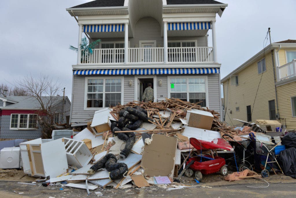
Thank you for this opportunity to express Toms River Township’s position, with respect to the utilization of the FEMA ABFE maps as the 100 year Base Flood Elevation for future construction. As detailed below, Toms River has numerous questions and serious concerns regarding use of this data, and, more importantly, based on indications from FEMA that these elevations may change, the ABFE maps have caused great confusion for our residents as they try to move forward. Although the early release of the ABFE maps was well-intentioned, the result was a virtual halt in all rebuilding efforts.
For instance, we have been advised by FEMA that the “V” zone designation in the back bay areas of the Township most likely will be downgraded; however, since NJAC 7:13 mandates the use of the ABFE, there is a strong possibility that residents in these areas will end up “overbuilding”, and as such, incur unnecessary costs or debt at a time when they can least afford to do so.
Find out what's happening in Manasquan-Belmarwith free, real-time updates from Patch.
Although constructing higher than the code minimum is not without its safety and insurance rate benefits, “V” zone construction in what may in fact turn out to be a future “A” zone will have little if any insurance benefit for its added construction cost. “V” zone construction can easily add $50,000.00 to the cost of raising a home. As we all know, FEMA’s ICC program only provides $30,000.00 for this purpose. The costs of physically raising the home, and disconnecting/reconnecting the utilities, typically consumes the ICC $30,000.00 grant. That leaves the piling costs to be borne by the homeowner. Our residents may be very upset to learn that they incurred this cost for no reason once the anticipated, less stringent, FIRM maps are adopted.
I have previously written to FEMA and expressed my concerns with the ABFE mapping. We met with FEMA representatives and have been advised by FEMA that their calculations are not complete, but that they believe the ABFE’s to be "conservative."
Find out what's happening in Manasquan-Belmarwith free, real-time updates from Patch.
I cannot say for certain whether I agree with this in all areas, having not been able to review calculations that do not yet exist; however, based on what we have been advised thus far by FEMA that the conditions experienced from super storm Sandy, in our area exceeded a 200 year-plus event, it is difficult to explain to residents, whose homes survived the storm with little or no damage, that they still need to upgrade based on the ABFE mapping. This mapping is supposed to be based on a projected 100 year event.
For more detail on my concerns, I would refer to my letter of December 19, 2012 to Mr. Scott Duell of FEMA, but in general terms, we saw very little wave action in areas such as Green Island, Silverton and along the Toms River. My field observations lead me to believe that there may be some areas, specifically some select areas directly fronting the Bay where perhaps a V Zone designation may be appropriate, only if the elevation warrants, but that the V Zone designation should not continue inland too far. As of now, areas of Green Island and Silverton had little or no impact from wave action, yet, these areas are currently designated as V zones in the ABFE maps.
Further, we would like to see the mapping revised to include more Hurricane Sandy High Water Marks as well as plotting homes that actually experienced wave action damage. This will help justify what areas need to be in the V zone in the final analysis.
I think at this point it is premature to discuss the barrier island until the dune easement issue is resolved. If that project is able to move forward, I agree with what FEMA has informed us, in that the BFE elevations should drop if sufficient dune and enlarged beach elevation areas are constructed.
In summation, I feel the ABFE should be used as an informal tool at this point only for residents and their design professionals. Based on the varying degree of their accuracy, residents should be allowed to consult with their design professional, insurance agent and based on their own experience with Superstorm Sandy, make their own design decisions, until such time as the FEMA modeling is accurately completed and gone through the review process.
My understanding of the normal FIRM approval process is such that all of the stakeholders have a chance to put forth their input. In some cases new data is presented and changes are made. The NJAC 7:13 emergency rule change bypassed all of that valuable scrutiny.
If you have any questions or require additional information please do not hesitate to contact me.
Robert J. Chankalian, PE, CME
Township Engineer, Toms River
Get more local news delivered straight to your inbox. Sign up for free Patch newsletters and alerts.


